Designing With Web - Part 3: week 1
Reinvent hiking experience for your parents based on internet of things
Group 115
- "Anne-Claire BALDE": https://mm.tt/1364851641?t=Bw00zuGPR1
- "Zijing LI": https://www.mindmeister.com/fr/1359203233?fbclid=IwAR3ZJOWe4TkgGxVoyG5DpgG5buvFMGl-01Am3zO7oSm1-MwDiJ4ksYg7W1E&t=YTNTvkKEm1
- "Aliénor DUPONT": https://mm.tt/1359898136?t=M7VKGlv7G2
- "Coline QUITTARD": https://www.mindmeister.com/fr/1364817508?fbclid=IwAR0bYwec2B2bHQTPnjNyN0DDWQ44PrG2mw5rf_VLgm4SUks0tRJuXIkcL18&t=EvccVE6VEm
- "Brice FOURE": https://www.mindmeister.com/fr/1362239453?fbclid=IwAR04f5gp-CwPn8OdHqShbeqlZn02UV51kFQUkMMg-MxPbgFANP9WJYlFj0k&t=1guJ7IBC5f
Project 1: Hikingfriends map
Context
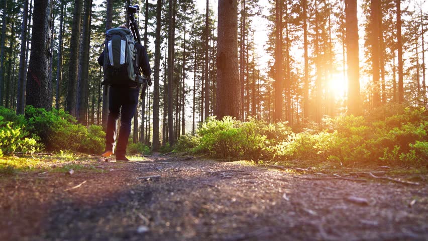
We have noticed a lack of information for hikers in real time. People know a lot about hiking but not what is happening on their trail. How can we give hikers information in real time? With our product, we would like to give to hikers the maximum of information about their trail in real time. Hikers would be able to anticipate any danger: bad weather, rock slide, presence of animals, traffic, closed road. The hikers could get some feedbacks from other hikers. This product will be released in 2020 online.
Target
The app will be accessible for every hiker who wants to use it. You don’t need to be an expert to use the app and inform people. The point is to make everyone concerned and involved to create content on the app to be more accurate.
Service offered
Hikingfriends Map is a connected browser that collects data. How does it work? First through our hikers’ network, everyone can create content on the platform. Our analyst will gather this information and if it is true, will update it in our platform. We will also cooperate with some GPS or wearing equipment companies to make sure the hiker can get through our platform whenever and wherever they are. This platform will also generate all the information and provide the convenient way to arrive to a destination. This platform will provide information to hikers before they join the trail and while they are on track.
Identity


Web interface
The development of our project requires the creation of a mobile application for our service. It will gather all information Hikers will be able to fill data about themselves into the app: name, age, weight, hiking routes, hiking number. The hikers will need to have a GPS, so it'll be possible to track their movement on a map. The application will say how long did the hiker walked, how many steps he made, the speed, the average heartbeat, their daily diary and daily feedbacks about the routes etc. Analyzing the data collected and their evolution, the app will be able to give advices to hikers and allow them to know if the route is safe. Moreover, if the software detects something abnormal, it can alert the emergency connector or even the local police. In conclusion, the platform will be composed by hikers’ “profile”, “current condition”, “advice” and “communication”parts
Benchmark
- Gaya: They propose trail maps for all your adventures
- Social networks: people can give information through social media
Project 2: Perfect hiking
Context
Most hiking guides tell us that we must be well equipped and check the weather before leaving. This is indeed a minimum, but it will not guarantee you a nice trip ! Often, some experience and knowledge are required to be at the right time in the right place for hiking. But for those who are not so lucky, it is not always easy to find a track that can be achieved at a given moment in a specific place by people with the level of difficulty required, especially when you have a precise idea of the hike you want to do.
Target
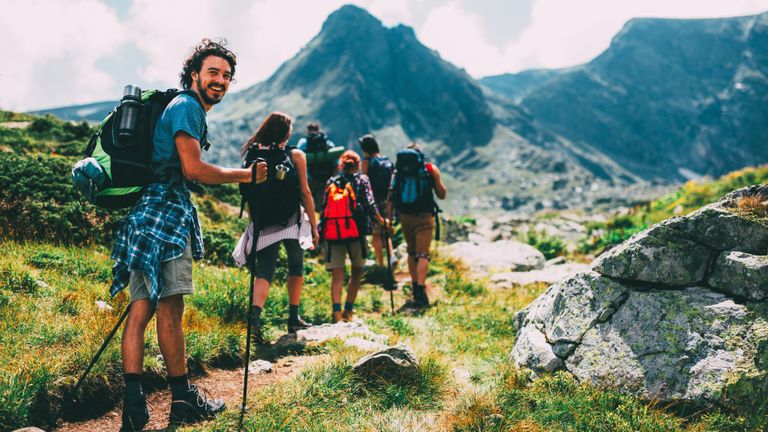
For hikers who wish to select a hike by ensuring that it will suit their possibilities, desires and goals. It is designed for casual hikers who want to do the best track for them but also for experienced ones who want to break their routine.
Service offered
The application will enable you to create and develop a personal itinerary on your smartphone by selecting specific criterias and follow it on the field through the application. Planning and searching a track according to its desires and goals is the guarantee to enjoy a reliable experience that suits each hiker. The application also offers the possibility to share courses with a community to inspire other hikers. List of criterias : starting point, locality of arrival, type of hiking, distance, duration, maximum altitude, period, level (beginner, medium, expert), accommodation, food supplies, viewing point
Identity

Web interface
The development of our project requires the creation of a mobile application for our service. First, users will encounter a list of items they have to check or not if they want them in their trail. Then, the app will select different trails according to their localisation and their criteria. The user has to select one of the trails and the app will summarize what is necessary to bring and all other informations about their trail. Finally, the app will follow him all along his hiking experience. Once the trail finished, the user has to update on the app if all the items he checked were indeed encountered during his trail, as a return of experience.
Benchmark
- "Mytrails": free app with maps